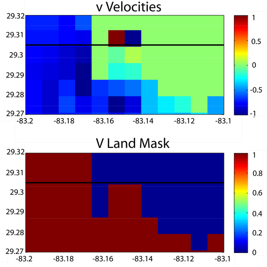
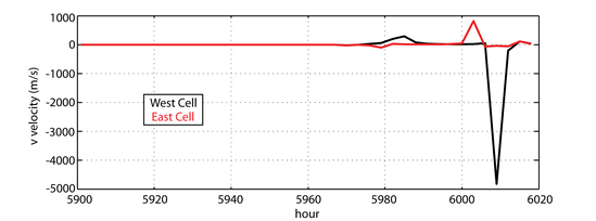
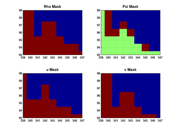
I deduced that I am getting large magnitude v velocities near my river sources. However, the velocities are occurring on what were previously (and still should be) land masked grid cells. I am defining my rivers as point sources using
#define UV_PSOURCE /*point sources*/
#define TS_PSOURCE /*point sources*/
An example of the blowup is included in the attached image, where in the land cells adjacent to the river, two juxtaposed grid cells have v velocities of 30 m/s and -293 m/s.

I have noticed that several other users have had problems with rivers in shallow water, but their concerns have been with large tracer values. Furthermore, since I have not activated any wetting / drying, I shouldn't be carrying velocities in land gird cells through time.
That all being said, I have a few speculations on what the issue could be, but your thoughts are of course welcome:
1. Is it possible that the v land mask is not being applied at the end of the integration?
2. Could the minimum depth (4m, 25 vert. layers) be too shallow?
3. Maybe I need to increase the height of the land from -1 m?
I should note that I ran the same month with point sources turned off (i.e. no rivers) and it does not blow up. I should also note that I am not using the most recent version of ROMS, instead I am working with version 240 (because it has already been downloaded and installed on our machine). I don't know if this is an issue that was addressed with the upgrade to version 3.3 or not.
Thanks for your help / thoughts in advance
Austin Todd


