I’m searching for the correct representation of mixed layer with stable stratification and (generally) moderate to low wind condition in a realistic basin/application. I would like to hear from you any useful comment, if any.
Application:
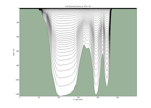
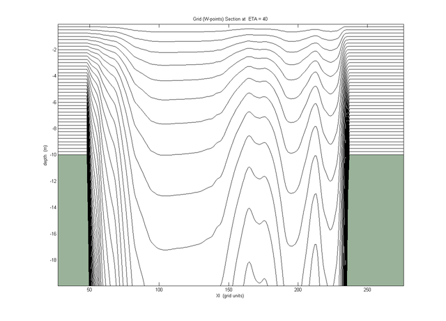
The sea is enclosed, with two straits at opposite sites. Depths range from coastal to very deep (1000m).
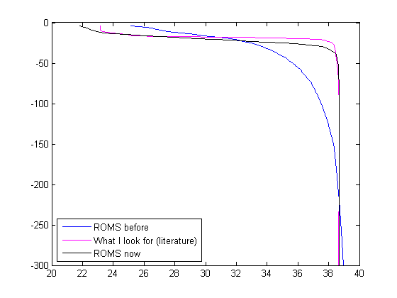
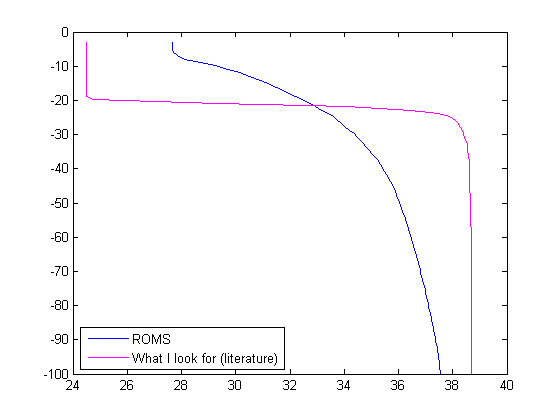
The vertical distribution of salinity show a very sharp halocline at 20 m, from say 20+ PSU in the surface layer to 39 right below the halocline (‘abrupt’ change in a couple of meters). This is a stable feature throughout the year, maintained by incoming low salinity flows from an adiacent sea, although actual values have some intraannual and interannual variability.
During summer-autumn the vertical structure is clearly statically stable and my simulation didn’t hit winter yet, when indeed some high wind condition and double diffusion processes may be found.
After 1 month after a realistic initial field (with sharp halocline/picnocline) and realistic forcing I got from ROMS a gentle halocline with surface salinity higher than what it should be (say, 2-3 PSU) and lower salinity below the haloocline down to 100m. In other words, my application is not able to maintain the sharp transition from the surface layer to the waters below.
Yep, I know, this is not really surprising. . .
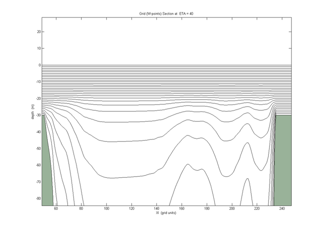
My vertical resolution is [theta_s theta_b Tcline Nlevels] = 7 0.3 20 40 , so fairly stretched at the surface with reasonable number of levels.
I'm running with
default advection scheme
#define DJ_GRADPS
#define TS_U3HADVECTION
#define TS_C4VADVECTION
#define TS_DIF2 (very low TNU2)
#define MIX_GEO_TS
#define GLS_MIXING (k-e)
#define KANTHA_CLAYSON
#define N2S2_HORAVG
Is there any way to get rid of the smooth, gentle halocline?
I suppose that if using z-level in the first 100-200m and terrain following below would help. But ROMS doesn't have that.
Also, it can be the turbulence closure scheme that mixes too much across the picnocline.
Any hint?
Thanks
Jacopo
 [/url]